Wales is a well known hot spot for hiking in the UK, with its rugged mountainous national parks and coastlines, it makes the perfect destination for anyone looking for adventure outdoors. The Cadair Idris Minffordd path is one of the most beautiful, yet challenging mountain routes in the Wales and definitely one to cross off your fitness bucket list!
As one of the highest mountains in the UK (based in the southern end of Snowdonia National Park), Cadair Idris has an elevation point of 893 metres and it’s peak is one of the most popular amongst mountaineers, walkers and hikers.
Cadair Idris is said to have inherited its name from the mythological giant Idris, which is also where the tradition of sleeping on the mountain comes from. There is a local legend that states ‘anyone who sleeps on the mountain alone will awaken skilled in one of the many talents of the giant, including the art of poetry and astronomy.’
Cadair Idris Routes
Made largely of Ordovician igneous rocks, the route to the summit is mostly an uphill climb and at parts you will need to scramble up the rocks which can be quite dangerous as they are largely loose and it’s easy to slip and fall to the bottom if you’re not careful. So choose the best route to suit your fitness level.
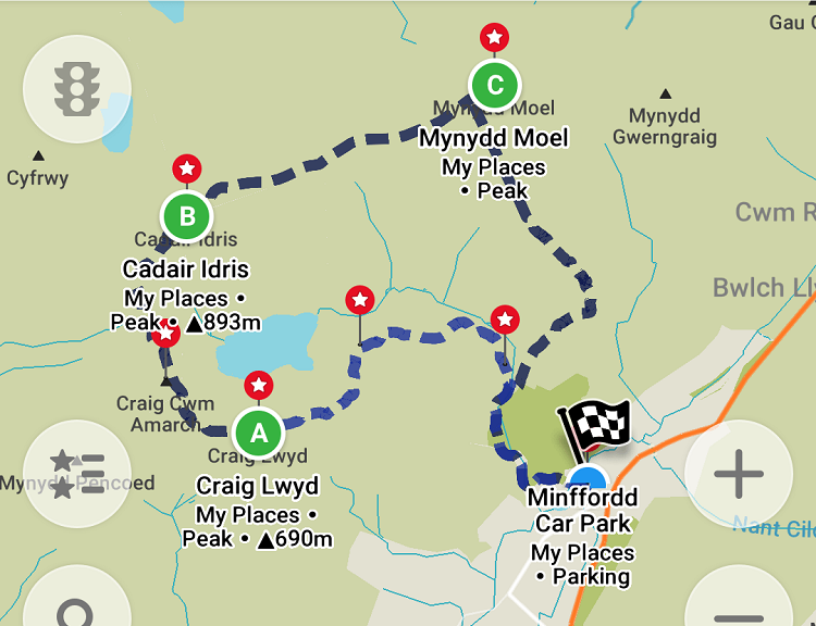
There are 3 routes that you can take up to the summit, with varying difficulty. The easiest, but longest route is the ‘Pony Path.’ The ‘Fox’s Path’ is the most direct route up the mountain. Lastly the Cadair Idris ‘Minffordd Path’ (the route we took) is the shortest but most difficult, with two climbs of over 300 metres to reach the summit.
Top Tip: Once you have decided on a route, search for a google map route to add to your phone as you will lose signal!
Hiking the Minffordd Path & Safety:
We decided the Minffordd path would be the best options to take, based on the view points, prettiest scenery, the uphill climb and the route seemed really easy to follow.
We checked the weather the day before an it was forecasting strong winds and rain, so we planned to start at 9am giving us enough time to reach the summit and make our descent with plenty of daylight hours left.
The Starting Point:
After fully planning out the climb, or so we thought, we ended up having a late start at 11am, but with the route being 5 hours long it we would still have enough time to complete the climb.
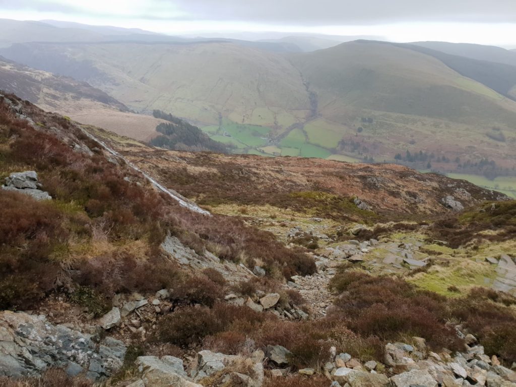
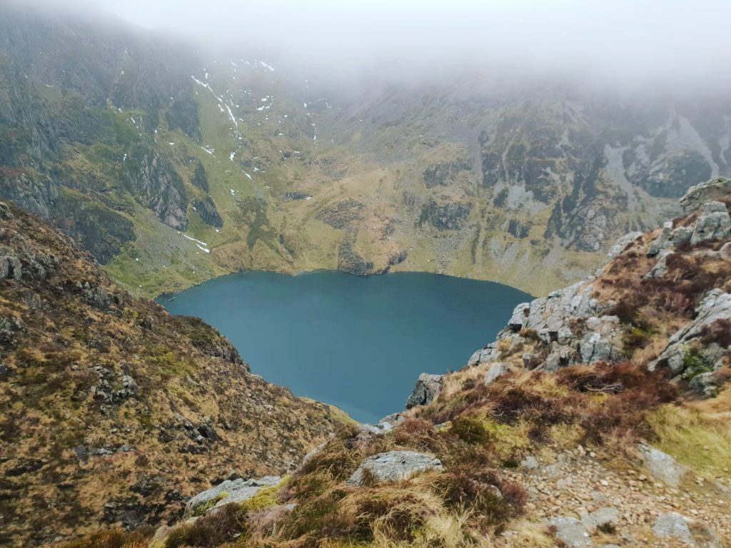
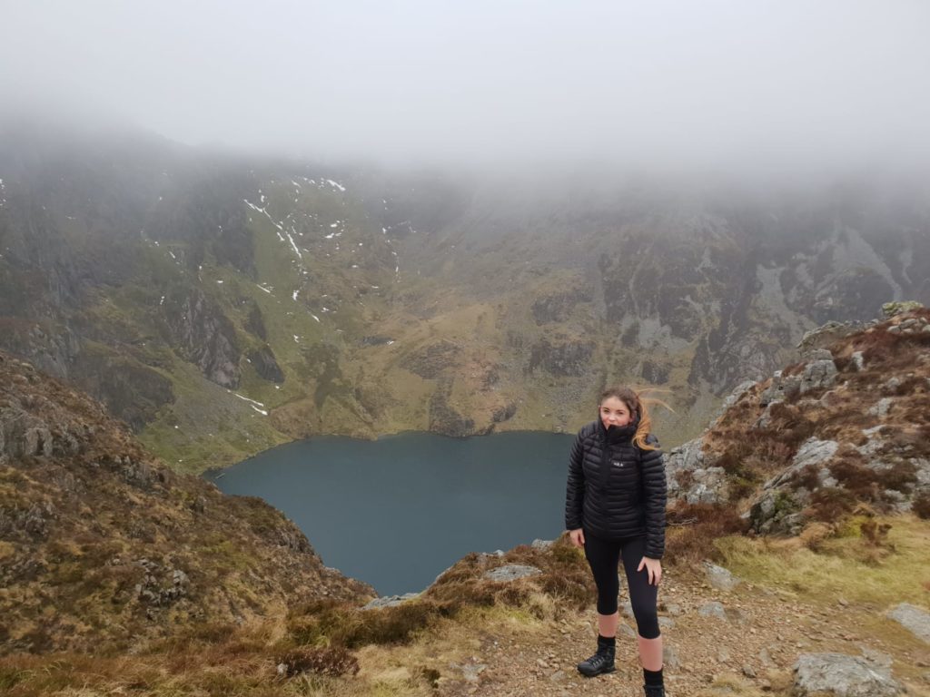
The first hour was tough as I was not mentally prepared for how steep the ascent would actually be from the get-go, as we passed the glacial Tal-y-llyn Lake, the weather took a dramatic turn and we had to battle against strong winds as we scrambled up the loose rocks on the next climb.
Top Tip: Be prepared for any type of weather condition, because we experienced them all from gail force icy winds to intense fog.
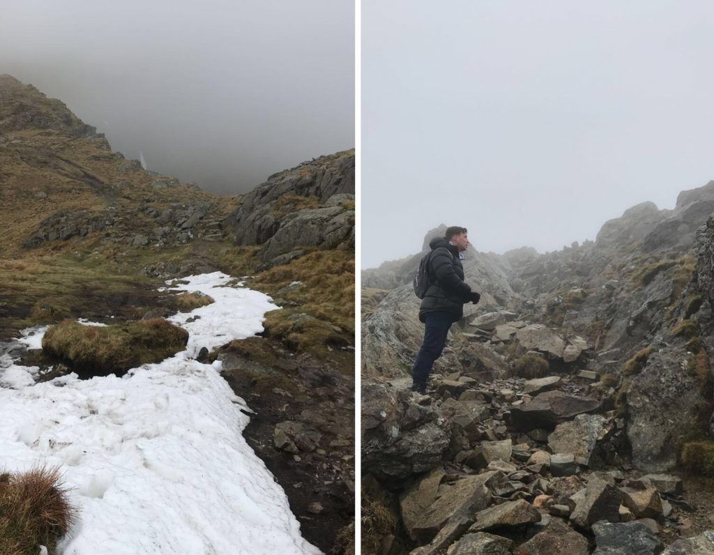
Difficult terrain and visibility:
As we got closer to the top of the mountain visibility decreased rapidly and we had to make a decision, do we carry on and risk the dangerous path or do we head back now? After already coming so far up we decided to carry on forward and try to reach the summit, but if visibility got worse we’d head back.
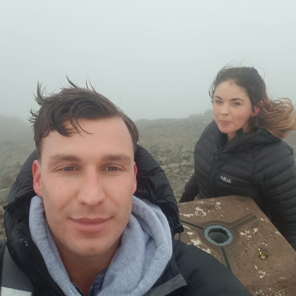
We finally reached the summit after what felt like forever, of of the best feelings in the world is being high up on a mountain looking back at what you’ve just climbed!
Safety Tip: Be careful of the Minffordd descent!
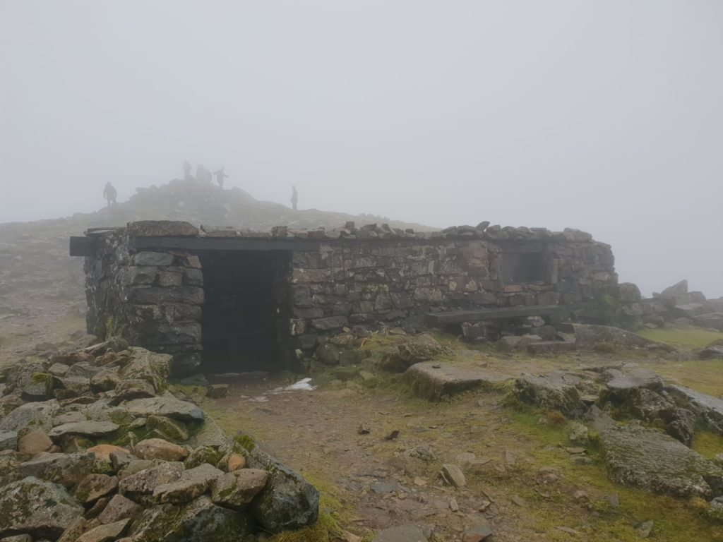
We took a short break in the summits bunker to refuel before heading back down, we planned to take the Minffordd loop (which takes you an alternative way back down) but as the visibility was so poor we tried to play it safe following the same route we took up the mountain.
The descent from the Summit:
As you leave the summit it’s easy to get disorientated and miss the turn off for the Minffordd Path, which is exactly what we did! Somehow we trekked 30 minutes in the wrong direction before realising we’d gone off course.
Luckily we had data reception to find our path to get us back on the correct route. But as we had to climb back up the summit peak with zero energy left, only limited battery life, 1.5 hours estimated time to finish and 2 hours of daylight left things got scary really fast!
Somehow the adrenaline kicked in and we raced back up the summit and rejoined our correct path, even though both of our phones had ran out of battery, we made it to the bottom in just over an hour by following a mix of the trail we could make out and footprints left by previous hikers.
Top Tip: Buy a cheap long-life battery phone for emergencies! Extremely cold or hot weather can affect your battery life and battery packs won’t always work.

Outdoor adventure website, focused around mountaineering, hiking, fitness and nutrition, sharing their outdoor adventures, routes and wellbeing advice.

